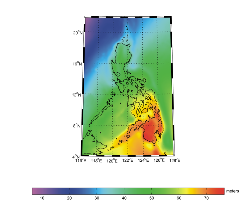
Description:
This is a geoid model for Philippines computed by the National Mapping and Resource Information Authority (NAMRIA). The geoid
covers the region 4-22°N, 112-128°E, and has a resolution of 0.025°. It is an update of the previous PGM2016 model,
using new satellite gravity and altimetry data and densified land gravity data. The same procedure of PGM2014 and PGM2016 was used in the computation of the PGM2018 model. The resulting gravimetric model was fitted to ITRF2005 GNSS/levelling benchmarks. The PGM2018
model has an estimated accuracy of 1.2 cm.
References:
R. Gatchalian, R. Forsberg, A. Olesen (2021). A new Philippine geoid model from airborne and terrestrial gravity data. Terrestrial, Atmospheric and Oceanic Sciences, 32(5), 913-920.
DOI: 10.3319/TAO.2021.11.15.01
Web of Science ID:
DRCI:DATA2024002028285523
|