Description:
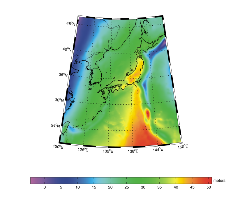
The JGEOID2008 model is an improved gravimetric geoid for Japan of the Geographical Survey Institute (http://www.gsi.go.jp). It is referred to the GRS80 ellipsoid in the ITRF94 frame (epoch 1997.0). It is developed on a 1'x1.5' grid by combining a GRACE-based global geopotential model, GGM02C, surface (land and ship-borne) gravity measurements, and the KMS2002 altimetry-derived marine gravity model. In the combination, a semidiscrete 2D wavelet analysis/reconstruction method is employed, selecting the spatial wavelength signals of the highest quality out of the respective data sets. Intercomparison with GPS/levelling geoid undulations shows a substantial improvement of JGEOID2008 over the previous JGEOID2004 model and reveals that the systematic errors at long wavelengths contained in JGEOID2004 have been effectively removed. Deviations of JGEOID2008 from the mean sea surface height at tidal stations on isolated islands are comparable to the differences in the sea surface dynamic heights (SSDH) in the Japan Sea, the Nansei Islands and the Izu Island chain from that in Tokyo Bay. The deviations show a good agreement with SSDH features estimated from oceanographic observation, indicating that JGEOID2008 has an accuracy within 10 cm. The geoid model is strongly expected to serve as a reference in ocean dynamics studies.
References:
Y. Kuroishi (2009). Improved geoid model determination for Japan from GRACE and a regional gravity field model. Earth,
Planets and Space, 61(7), 807-813. DOI: 10.1186/BF03353191
Web of Science ID:
DRCI:DATA2018029012462761
|