Colorado - USA (ColWLSC2020)
|
Authors: R. Barzaghi, D. Carrion, Ö. Koç
|
Created: 2020
|
Resp: R. Barzaghi |
Description:
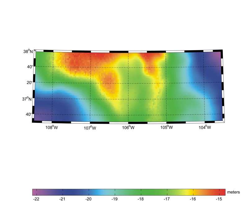
The ColWLSC2020 quasi-geoid and geoid models are gravimetric models and have been computed by the Department of Civil and Environmental Engineering, Politecnico di Milano. The models have been computed in
the frame of the International Association of Geodesy Joint Working Group 2.2.2 "The 1 cm geoid experiment" and the so called "Colorado
experiment". The area covered by the models is 251.5°E ≤ longitude ≤ 256.5°E, 36.5°N ≤ latitude ≤ 38°N with a grid spacing of 2' in both
latitude and in longitude. The computation is based on the remove-compute-restore technique with XGM2106 being used as a reference field.
The topographic effects were treated using a Residual Terrain Correction (RTC) by solving the spectral filter problem of RTC using Earth2014
and ERTM2160 models. The input gravity data include terrestrial and airborne data combined using Least-Squares Collocation (LSC). The final
estimation was carried out using Windowed LSC (WLSC). The mean accuracy of the geoid models, when compared against GSVS17 GPS/leveling, is
at the 2.4-2.8 cm level.
Model Citations:
R. Barzaghi, D. Carrion, Ö. Koç (2020): The PoliMI quasi-geoid based on windowed Least-Squares Collocation for
the Colorado Experiment: ColWLSC2020. V. 1.0. GFZ Data Services. DOI: 10.5880/isg.2020.001
R. Barzaghi, D. Carrion, Ö. Koç (2020): The PoliMI geoid based on windowed Least-Squares Collocation for
the Colorado Experiment: ColWLSC2020. V. 1.0. GFZ Data Services. DOI: 10.5880/isg.2020.002
Reference:
V.N. Grigoriadis, G.S. Vergos, R. Barzaghi, D. Carrion, Ö. Koç (2021). Collocation and FFT-based geoid estimation within the Colorado 1 cm geoid experiment. Journal of Geodesy, 95, 52. DOI: 10.1007/s00190-021-01507-7
Web of Science ID:
DRCI:DATA2020022018150699
Digital object identifier:
DOI: 10.5880/isg.2020.001 (quasi-geoid in ISG format)
DOI: 10.5880/isg.2020.002
(geoid in ISG format)
|
|