Description:
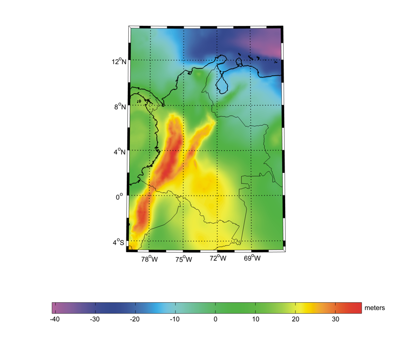
GEOCOL2004 is a gravimetric geoid model for Colombia, with a spatial resolution of 2'x2' and referred to the GRS80 normal ellipsoid.
It is based on terrestrial gravity measurements from national databases, from the Defense Mapping Agency (DMA) and from oil companies.
Aerial gravimetry is used in the Amazon rainforest, while satellite altimetry is used over marine areas close to coasts. The quasi-geoid
determination is based on Stokes integration in the framework of a remove-restore procedure, where long wavelengths come from the TEG-4
geopotential model up to degree and order 200. The terrain contribution is computed from the GTOPO30 model in the continental areas and
from Geosat/ERS1 satellite altimetry over the oceans. The estimated height anomalies are finally converted to geoid heights by exploiting
Helmert's second method of condensation. The comparison between the GEOCOL2004 gravimetric model and independent GPS/levelling data shows
differences with a mean of about 2 m and a standard deviation of about 50 cm.
References:
L. Sánchez (2003). Determinación de la superficie vertical de referencia para Colombia. Thesis at Technische Universität Dresden,
Germany (in Spanish
and in German).
Web of Science ID:
DRCI:DATA2019226017247343
|